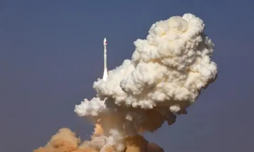
Pakistan’s space agency stated that Sunday’s launch of its first Hyperspectral Satellite (HS-1) from a Chinese launch center was “a breakthrough achievement.”
According to a study in the Journal of Computational Intelligence and Neuroscience, satellites that use hyperspectral imaging, a form of sophisticated camera technology, are used to investigate the Earth and space.
Hyperspectral cameras record hundreds of extremely small color bands, in contrast to standard satellite cameras that only record a few colors (such as red, green, and blue). This implies that they are able to pick up on minute variations in light that are invisible to the human eye or even to standard satellites.
“The country’s space agency today announced a breakthrough achievement with the successful launch of Pakistan’s first Hyperspectral Satellite (HS-1) from China,” the Pakistan Space and Upper Atmosphere Research Commission (Suparco) said in a statement released today.
“HS-1 satellite is engineered to capture ultra-precise hyperspectral imagery across hundreds of narrow spectral bands, offering unprecedented resolution for the analysis of land, vegetation, water, and urban features,” the statement explained, outlining the satellite’s capabilities.
It claimed that Pakistan’s ability to practice precision agriculture, strict environmental monitoring, urban planning, and proactive disaster management will all be significantly enhanced by the state-of-the-art technology.
“HS-1 will enable the country to accurately map water quality, soil moisture, and crop vitality while closely monitoring pollution, deforestation, and glacial melt.”
The satellite would “improve post-disaster assessments and early warning systems for catastrophic events like floods and landslides, especially across the northern regions,” the statement continued.
The satellite is also anticipated to support “development initiatives such as CPEC by preemptively identifying geo-hazard risks and guiding sustainable infrastructure development,” according to the organization.
According to the release, Muhammad Yousaf Khan, Chairman of Suparco, “expressed profound gratitude for the Government of Pakistan’s support in bringing this pivotal national project to fruition.”
“The Hyperspectral Satellite’s data has the potential to transform agricultural productivity, enhance climate resilience, and facilitate the most efficient use of the nation’s essential natural resources.”
“The mission reflects the ever-growing strategic partnership and deep-rooted friendship between the two nations, who continue to cooperate in advancing peaceful space exploration and harnessing its benefits for socioeconomic development,” the space agency added, highlighting the long-standing space science partnership between Pakistan and China.
Suparco’s crucial role in promoting national socioeconomic prosperity through creative space applications is further reinforced by the successful integration of HS-1 into Pakistan’s growing space fleet, which represents a significant step toward establishing space technology excellence.
As stated in the press release, the satellite “signals a definitive leap in Pakistan’s ambitious space roadmap, positioning the nation as an emerging leader in space technology for sustainable development,” according to Project Director HS-1 Mushtaque Hussain Soomro.
According to the statement, he also praised the mission team’s combined commitment and technological mastery.
Prime Minister Shehbaz Sharif thanked Pakistani scientists and engineers for the successful launch in a statement released by his office.
According to the PM, “Pakistan and China’s cooperation in space research, like in other sectors, is exemplary and of key importance.” For this excellent cooperation, we are thankful to China, our great and longstanding ally and strategic partner.
“The Chinese leadership and people are at the center of Pakistanis’ hearts,” he continued.
The satellite would assist Pakistan in studying regional variances and environmental changes, the release said.
“This development will be a significant turning point in the fight against the negative consequences of climate change,” PM Shehbaz stated. “National capabilities in fields like agriculture, environmental monitoring, urban planning, and disaster management will be greatly enhanced by the satellite.”
In a separate statement released today, the foreign office described the development as “a pivotal step forward in Pakistan’s space program” and referred to it as a significant milestone.
🔊PR No.3️⃣1️⃣0️⃣/2️⃣0️⃣2️⃣5️⃣
— Ministry of Foreign Affairs – Pakistan (@ForeignOfficePk) October 19, 2025
SUPARCO Successfully Launches Pakistan’s First Hyperspectral Satellite https://t.co/N6dil4vaMe
🔗⬇️ pic.twitter.com/rFDSSIcstv
According to FO, Suparco’s dedication to using space technology for national development is reaffirmed by the launch.
Additionally, it “emphasizes the longstanding partnership between China and Pakistan in the peaceful exploration of space and its application for socioeconomic progress.”
The announcement read, “Foreign Minister Mohammad Ishaq Dar commended the Chinese and Pakistani scientific and technical teams working on HS-1 for their dedication, professional excellence, and exemplary cooperation.”
Suparco declared on October 15 that the HS-1 satellite would soon be launched from China’s Jiuquan Satellite Launch Centre.
A top Suparco official stated last month that the organization was “paving a path anchored in science and international collaboration to better prepare for natural calamities” by incorporating space-based technology into its disaster risk management framework.
A Chinese remote sensing satellite was successfully launched in July, according to the foreign ministry, with the goal of “enhancing Pakistan’s agricultural monitoring and disaster management, among other capabilities.”
A remote sensing satellite was successfully launched by Pakistan from a Chinese launch center in August. According to a Foreign Office statement, the satellite was intended to improve Pakistan’s capacity for disaster relief and agricultural monitoring, among other things.
SOURCE: DAWN NEWS


